Link to WebGIS : https://cnr-ispc.shinyapps.io/SacredCoins/
In recent years, ancient numismatics has made use of IT tools to collect, catalog and analyze all the existing documentation on the subject.
With “Sacred Coins” WebGIS, a tool was made available to organize and make easily accessible all the information on the deposition of Punic and neo-Punic coins in the civil, sacred and funerary contexts in the ancient Mediterranean.
The WebGIS is continuously implemented with the insertion of new numismatic and geographic data relating to the various areas of study relating of the finds, in order to obtain the distribution of the monetary finds, but above all to highlight the space-time relationships with other contexts that have similar characteristics. geographical and environmental.
It is important to emphasize that not all the specifications of the coins can be completed due to the absence of precise information in the reference bibliography.
The GIS in archeology, in addition to defining a collection point for all published and unedited information, has the precise function of providing valid decision support and facilitating the orientation of territorial governance choices. Thus, GIS becomes a container of the entire dataset that allows to overlap and process data of different types such as remote sensing, cartographic, bibliographic and numismatic. These systems therefore allow the crossing of large amounts of information and the creation of targeted searches.
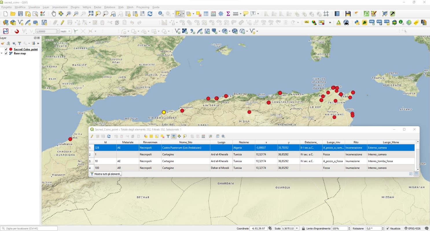
For the creation of the GIS, the “Sacred Coins” geoDB was used as a basis, where each line represents a find and contains a whole series of information regarding the point (Fig.1).

Fig.1 “Sacred Coins” GIS
To represent and visualize the data the QGIS software was chosen (v. 3.26, long term), an application that allows to view, organize, analyse and represent spatial data.
The GIS consists of a geo-referenced map of the Mediterranean basin, with a series of geocoded points that represent the single items present in the geoDB; these points will provide the user with a schematic understanding of the finding data.
The georeferencing of the geoDB takes place by means of the two fields that contain the geographic coordinates of the site where the coins were found, latitude and longitude in the reference system (datum) WGS84. Each point is projected on a basic or historical cartography, on an aerial or satellite image, provided that these are georeferenced. Each point can be queried by opening a window which contains the table information relating to that point.
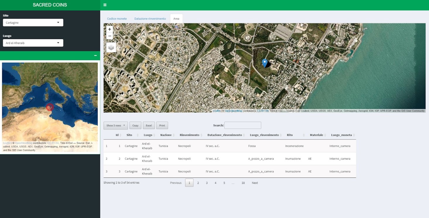
From geoDB and GIS we then moved on to the publication and dissemination of data through the webGIS (Fig. 2).

Fig.2 – “Sacred Coins” WebGIS (R-Shiny)
Therefore, a WebGIS is the extension to the web of applications created and developed to manage numerical cartography. A WebGIS project differs from a GIS project for its specific communication purposes: it is no longer a local tool but becomes a tool for sharing information with other users.
The area of interest is a part of the Mediterranean basin that goes from North Africa to Malta, Sicily, Sardinia and the South of the Iberian Peninsula. The extension of the area of interest makes it necessary to choose a scale with an adequate geographic coordinate system.
The cartographic basis of the webGIS is provided by Leaflet, an Open Source JavaScript library. Leaflet allows to recall various cartographic bases according to the coordinates of one or more elements. In particular, two bases were chosen in the “Sacred Coins” WebGIS, one with satellite images and the other with street maps.
The “Sacred Coins” WebGIS is made up of three levels.
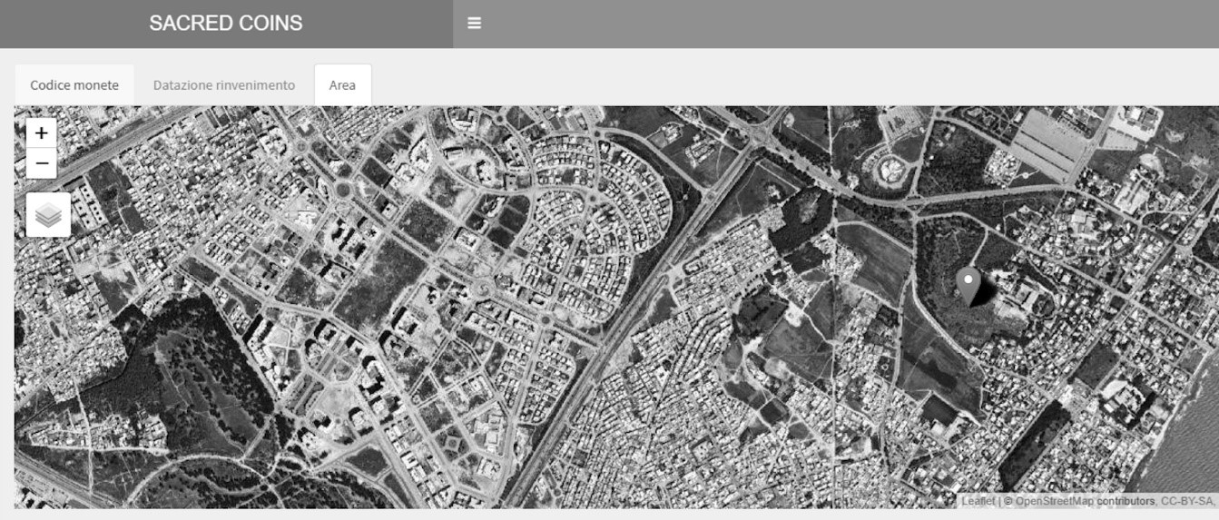
The first level is the main one (Fig. 3), where it is possible to choose the thematism, the type of cartographic base and the zoom.

Fig.3 -“Sacred Coins” WebGIS: first level.
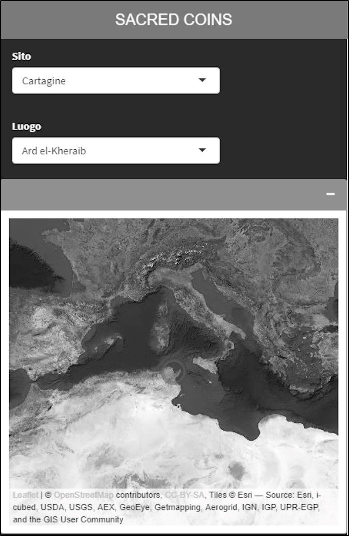
In the second level (Fig.4), searches can be made within the dataframe; according to these selections, the results of these searches are projected on the cartographic base of the main panel through a placeholder.

Fig.4 -“Sacred Coins” WebGIS: second level.
In the third box (Fig.5), depending on the choices made in the previous levels, only the selected part of the dataframe is displayed in table form. In this space it is possible to customize the table display and to print or save the table in different formats.

Fig.5 -“Sacred Coins” WebGIS: third level.
GIS is a very useful tools for archaeological research but the accuracy of the result depends on the methodology adopted in the collection, cataloging and insertion of all types of documentation (bibliographic, archival, iconographic, land and aerial recognition) and on the data analysis. Following this approach, the “Sacred Coins” GIS and webGIS are constantly updated with the information collected with traditional and modern research activities.
